
Grand Gravel

description
** This is not a normal BRM. It is a gravel ride. 66% of this ride is off road **
Included > forest and farm tracks, loose gravel, cobble stones and grass sections. Tyres of at least 32mm (ideally 35–40mm) with some tread, is recommended.
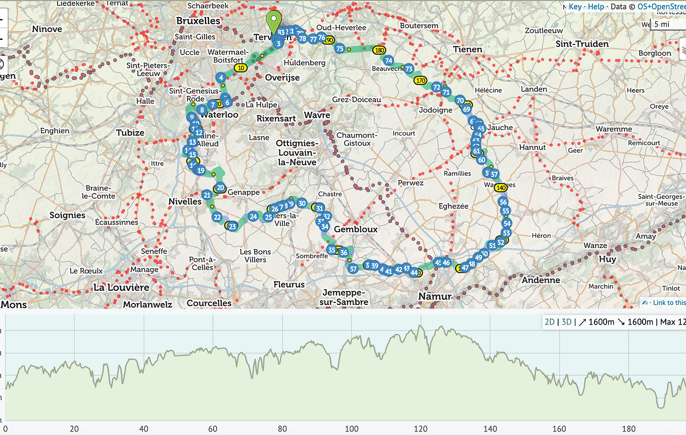
Start at Tervuren, by weaving south through the Forêt de Soignes before dropping into the Brabant Wallon countryside and looping back north through Namur and Brabant Flamand. The 1,600m of climbing is spread across rolling farmland, wooded climbs, and quiet valley roads — nothing brutal, but relentless enough to make every café stop feel earned.
The first third takes you through the green corridors around Hoeilaart and Clair Bois before the route opens up into the wide agricultural plains south of Brussels. You'll pass the ruins at Villers-la-Ville, the moated castle of Corroy-le-Château, and the quiet Meuse tributaries around Mazy and Isnes.
East of Namur, the route climbs through Pontillas and Meeffe into the dry, open plateau of Hesbaye. The return leg traces ancient Roman roads through Orp-Jauche and Marilles before descending back into Flemish Brabant via Beauvechain, Neerrijse, and the final wooded stretch into Vossem and Tervuren.
passing through
Teruven - Hoeilart - Clair Bois - Sart Moulin - Lillios Witterzee - Thines - Houtain le Val - Villers la Ville(C) - Gentinnes - Corroy le Chateau - Bothey - Mazy - Isnes - Rhisnies - Daussouix - Cognelee - Bonnine(C) - Basse Maquelette - Pontillas - Meeffe - Wasseiges - Merdorp - Jauche(C) - Marilles - Saint Jean Geest - L142 - L'Ecluse - Beauvechain - Tomberg - Sint Joris Weert - Neerrijse - Vossem - Tervuren
stops
Villers La Ville -
Le Chalet de la foret, 70.5k
Bonnine - SPAR 121k
Jaunche - Cafe Le Rustique, 152k